
Post a comment on the text below
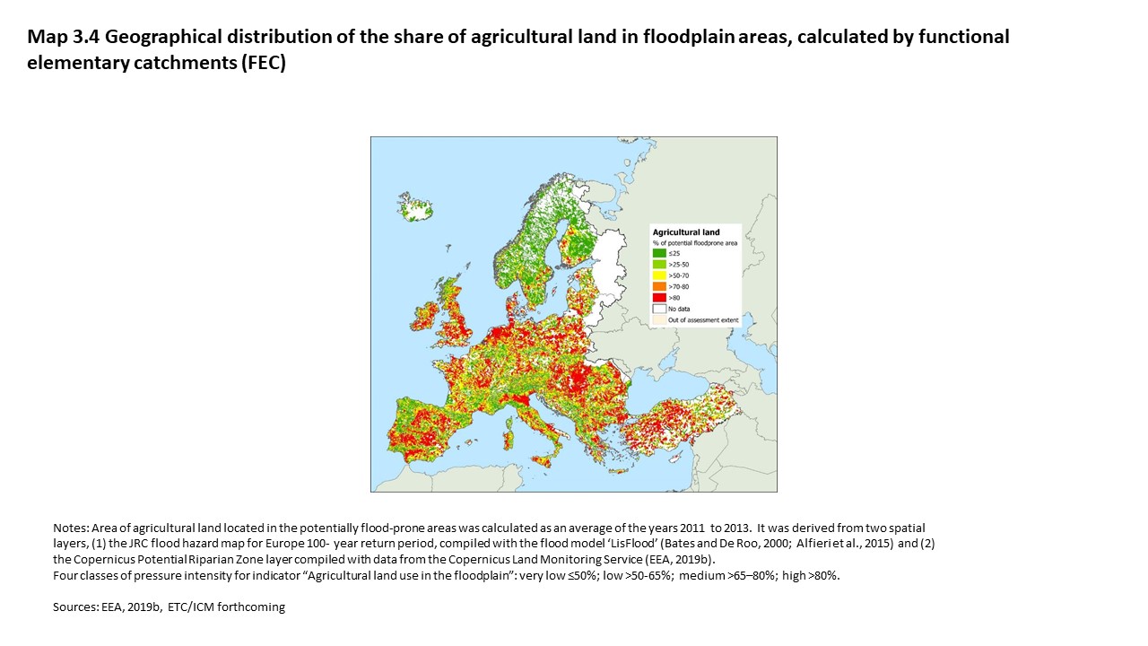
3.2.3 The share of agricultural land in floodplains as proxy indicator
Agriculture is linked with around 42% of land use activities in European floodplains (EEA, 2019c). Given the lack of EU-wide data availability on the full extent of hydromorphological pressures caused by agriculture, the share of agricultural land in floodplains can be used as a proxy indicator for such pressures. This assumes that the larger the share of arable land and permanent crops in the floodplain, the more an area is likely to be affected by hydromorphological pressures from agriculture, but it does not specify which pressures.
Map 3.3 illustrates that in most functional elementary catchments, the share of agriculture land in floodplains is substantial, especially in lowland areas (medium to high intensity of proxy indicator). The share of agricultural land in flood-prone areas is lower in mountainous regions such as large parts of Scandinavia and the Alps (very low to low intensity of proxy indicator).
You cannot post comments to this consultation because you are not authenticated. Please log in.